The Smart Way To Map Spaces
GEOSLAM – Handheld Laser scanners
Rapid Scanning – Map anywhere
ZEB go
If you’re looking for a reliable way to map and understand spaces, meet the ZEB Go – your first step in SLAM handheld technology.
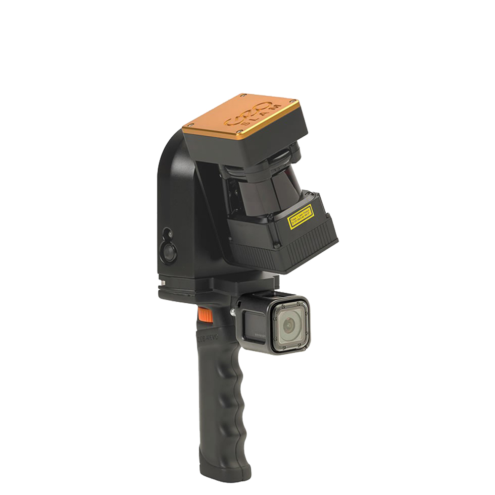
Zeb revo rt
Handheld, lightweight and easy to use, the ZEB Revo RT allows you to build highly accurate 3D models within minutes, while on the move.
Zeb horizon
With a range of 100m, the ZEB Horizon is great for outdoor use. Its lightweight and compact design also make it perfect for indoor surveys.
Which is the right GeoSLAM solution for you?
GEOSLAM Scanners are versitile pieces of equipment which can be utilised in a variety of applications.
Floorplans
- Capture your own data
- Not reliant on photogrammetry
- Data storage options
- Add photos, notes and more
- You own 100% of the data
Construction
- Automated project progress
- track your construction progress
- in-sourced data collection
- Share data and information quickly & easily
BIM
- Rapid scanning to create a BIM Model
- Cover large areas with GEOSLAM
- Import, View and Interrogate data
- Stairs, small rooms, tight spaces and GNSS denied environments.
Stockpile
- Accurate analysis of material on sites
- Ensure accurate reporting of mined materials
- Stock takes and auditing
- Improve your supply chain
GEOSLAM
Handheld laser scanners
Affordable Laser Scanning
Useable Indoors and Underground
Device Flexibility
Software that works for you

Scan Faster than ever before
Multiple Applications
GeoSLAM makes it easy to capture and connect data from the world around us. From the built environment to the natural world, GeoSLAM technology gives people the power to collect geospatial data from some of the most difficult environments, whether they are indoor, outdoors, underground – everywhere.

All terrain scanning
Mount on your back using our available accessories for easy scanning

Cavity Scanning
Scan those tight and hard to reach areas. Mines, Caves, Cavities, Containers and more

Next Level Scanning
Scan to the highest level of accuracy and recreate perfect models of highly detailed objects, buildings and more.
1 Tool – So many Ways To use it
Versitile scanning options
ZEB DISCOVERY
LiDAR and high resolution imagery
The strongest SLAM algorithm on the market, now available with ultra-high definition imagery from the NCTech iStar Pulsar camera.
Features with the ZEB Discovery:
UAV Mount
Create 3D point clouds using the strongest UAV SLAM
Collect 300,000 data points per second from the world around you.
Using a standard ZEB Horizon with one of our quick release drone mounts, you can go from walking to flying in minutes.
ZEB Locate
LiDAR and high resolution imagery
The strongest SLAM algorithm on the market, now available with ultra-high definition imagery from the NCTech iStar Pulsar camera.
Features with the ZEB Discovery:
Multiple Applications
GEOSLAM ZEB HORIZON

Real Work. Real Results.
Real World Applications
GEOSLAM
Zeb Laser Scanner Range
Which Scanner is Right for you?
Get the right zeb
ZEB Go
Used mostly for scanning indoors or in underground mines and caves with an IP64 rating. Can be used for applications such as construction/BIM or creating floorplans. Can be used outdoors and has a range of 30m.
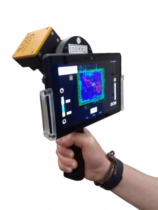
ZEB Revo RT
Real-time processing which means you can visualise the scan as you move. Has a range of 30m and IP51 rating. Used mostly for scanning indoors and utilised for applications such as construction/BIM or creating floorplans.
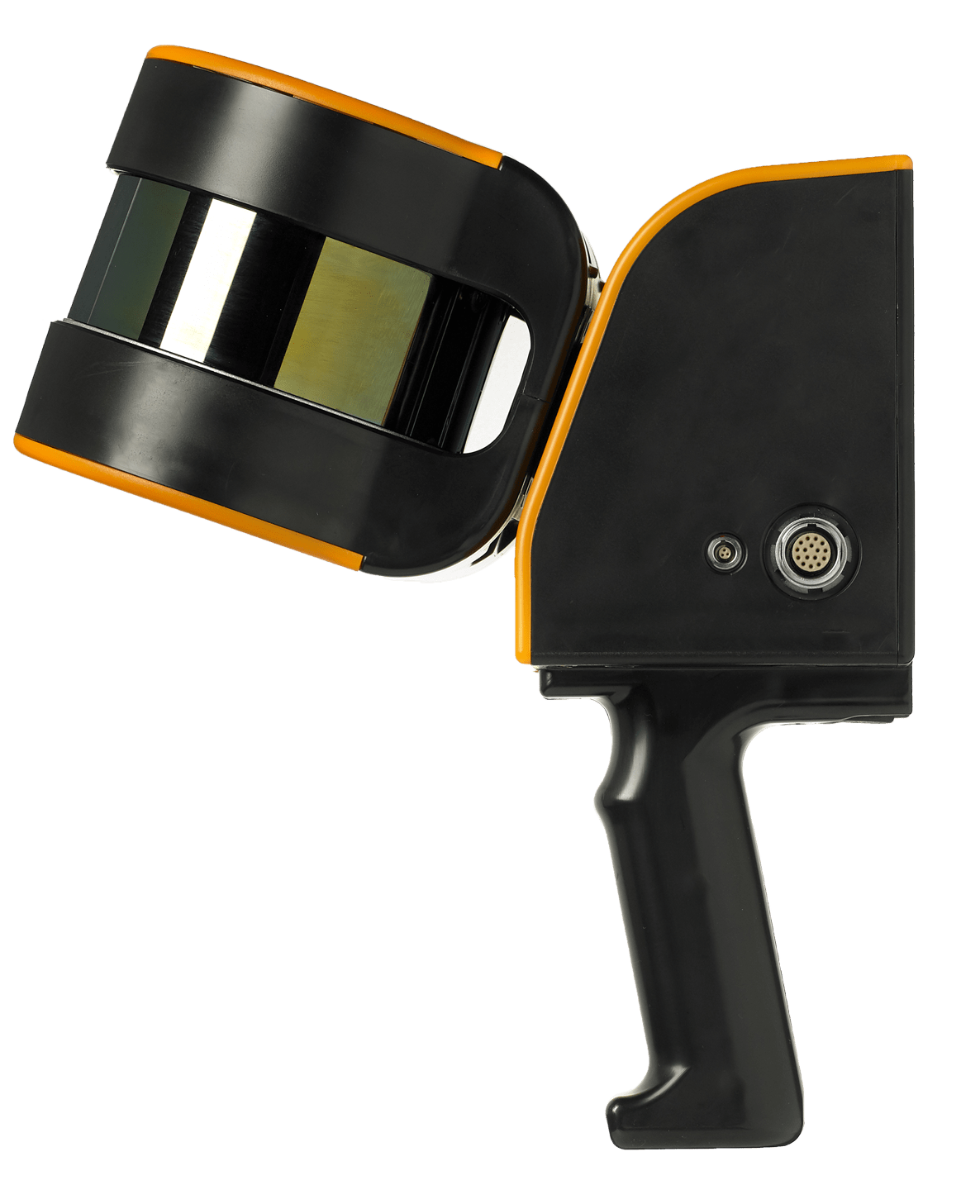
ZEB Horizon
The most flexible of the ZEB family with a range of accessories which makes it suitable for lots of different applications. Can be used to scan indoors and outdoors with a longer range of 100m. Collect data using a UAV or vehicle, or pair with a backpack and GPS antenna for precise location positioning.
Contact us today
Want to know more about the GEOSLAM products contact us today to find out how you can innovate your workflow.