
MicroSurvey
FIELDGenius
FieldGenius is a popular Field Survey Software app built for Windows and Android Tablets, Computers and devices.
This article aims to have all the required training videos available for customers to be able to reference when looking to do different applications within FieldGenius.
Start New project
This video aims to breakdown the starting of a new project using FieldGenius.
Storing Points & Linework in FieldGenius
How to store points and line work in FieldGenius using a GNSS Receiver.
GPS Offset
How to use the GPS offset measurement mode in FieldGenius
Point Averaging
This video enables you to take multiple redundant measurements and allows you to summarise them.
Configure GPS Rover
This video aims to go over the configuration of GPS rovers to a radio RTK Link
Configure GPS Base
This video goes over setting up a GNSS Base upon startup of FieldGenius
Configure Data
Collector
This video aims to step by step setup the Data Collector via the internet connection method.
GNSS Localization Part 1
This video will go over the process of storing 2 points to setup your site localization.
GNSS Localization Part 2
This video will complete the process of setting up your site localization.
Local Transformation to
Point Day 1
This video will go over the procedure for local transformation to point for work day 1.
Local Transformation to
Point Day 2
This video will go over the procedure for local transformation to point Day 2.
Average Geodetic Day 1
This video will walk you through the process of setting up an Average Geodetic for work day 1.
Known Geodetic Method
This video will go over the purpose of the known geodetic method for configuring your base.
How To Use
Tolerance Modes
This video will go over the ability to use tolerance modes as a way of taking control of the quality and the speed to collect GPS Measurements.
Helmert Transformation
This video will go through the process of entering a 7 parameter helmert transformation for application to all of your GPS measured points.
Example of a User Defined Coordinate System
This video do an example of a user defined coordinate system which will allow you to collect points in an existing coordinate system using a GPs and FieldGenius.
Electronic Bubble Support
This video will explain how to check for current level position, allows for rough compass direction, prevent from storing out of level positions and more.
Importing Localization
Parameters
This video will explain how to import localization parameters from a previous Fieldgenius or from a Carlson Surv CE Project.
From The Blog
Mauris non tempor quam, et lacinia sapien. Mauris accumsan eros eget libero posuere vulputate.
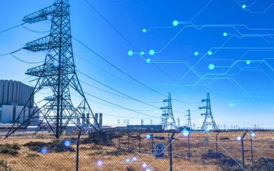
Electricity Tower IOT Structural Monitoring
Electricty Tower IOT Structural MonitoringFor electricity utility companies the biggest form of outages of their network comes from supply towers failing. Although utility companies monitor the changes in electricity transmission, collection of customer data and the...

Different Types of SHM: Which one to Choose?
Different Types of SHM: Which one to Choose? Depending on the structure and on the need of the monitoring project, there are different types of structural analysis that can be done. They tend to be divided into two main groups: static analysis and dynamic analysis....
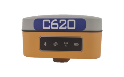
GNSS Test Orbit C620
Correction vs Non Correction DataThe Difference Between Correctio & Non Correction DataWe decided to put the Compact C620 Under a corrections test. This test was based around understanding how well the GNSS Receiver performed without correction on a known...