

Carlson SurvPC Software
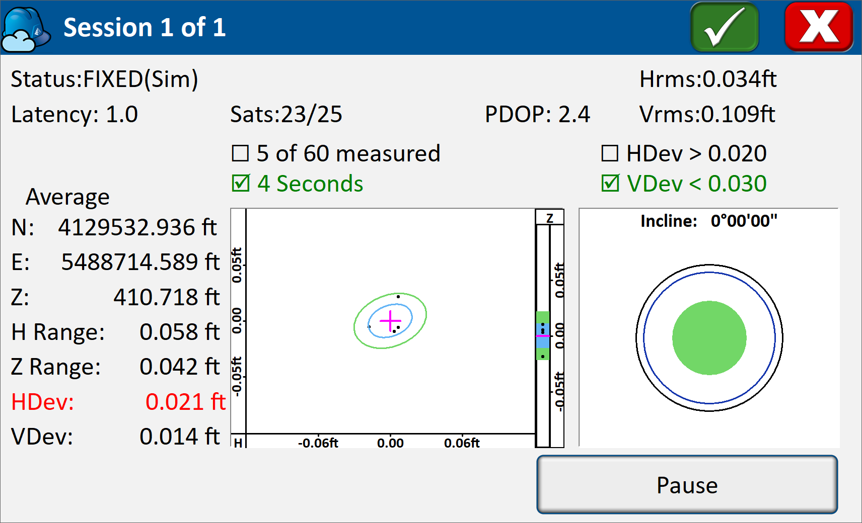
There’s a reason surveyors make Carlson their first choice in data collection software. SurvPC combines advanced functionality including GNSS averaging, least squares adjustment in the field, Esri® integration, roading capabilities, and Hybrid+ with ease-of-use and award-winning technical support.
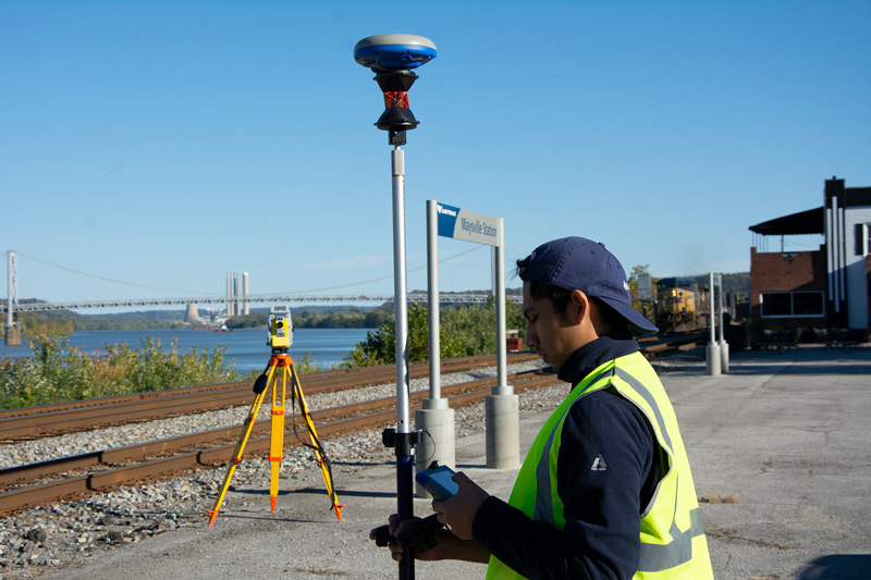
Both SurvPC and SurvCE support the widest range of popular and newly released RTK GPS and conventional and robotic total stations, putting the power of Carlson’s in-field coordinate geometry at your fingertips.
Above-the-fold product description
The Carlson SurvPC Survey Data Collection Software is a professional field surveying solution designed for accurate GNSS data collection, total station operation, construction set-out, and survey calculations. Built for Windows-based field controllers and tablets, SurvPC combines powerful surveying tools with an intuitive interface to streamline everyday fieldwork.
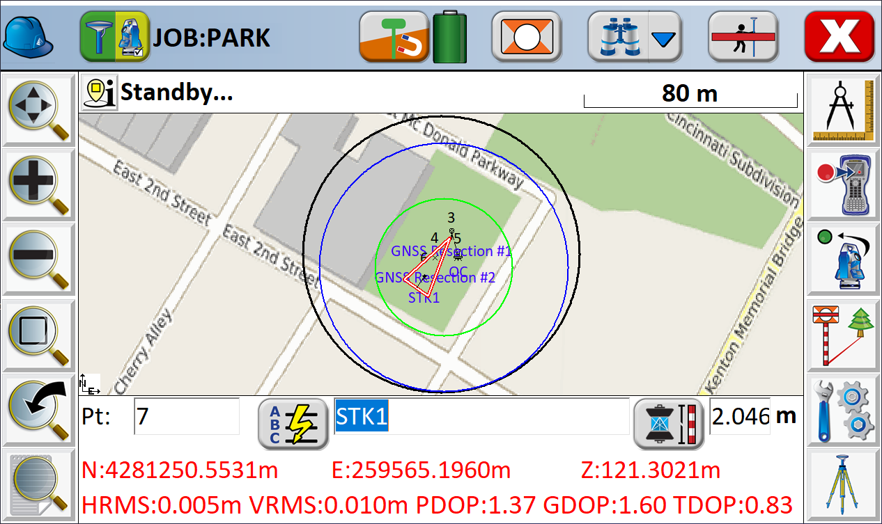
Featuring advanced coordinate geometry (COGO), GNSS averaging, field-based least squares adjustment, road staking, and Esri ArcGIS integration, Carlson SurvPC helps surveyors, engineers, and construction professionals collect, manage, and process survey data efficiently.
Professional Field Surveying & Data Collection Software
Carlson SurvPC is an advanced survey data collection platform developed for land surveyors, civil engineers, construction contractors, and GIS professionals who need reliable field measurement, calculation, and set-out capabilities.
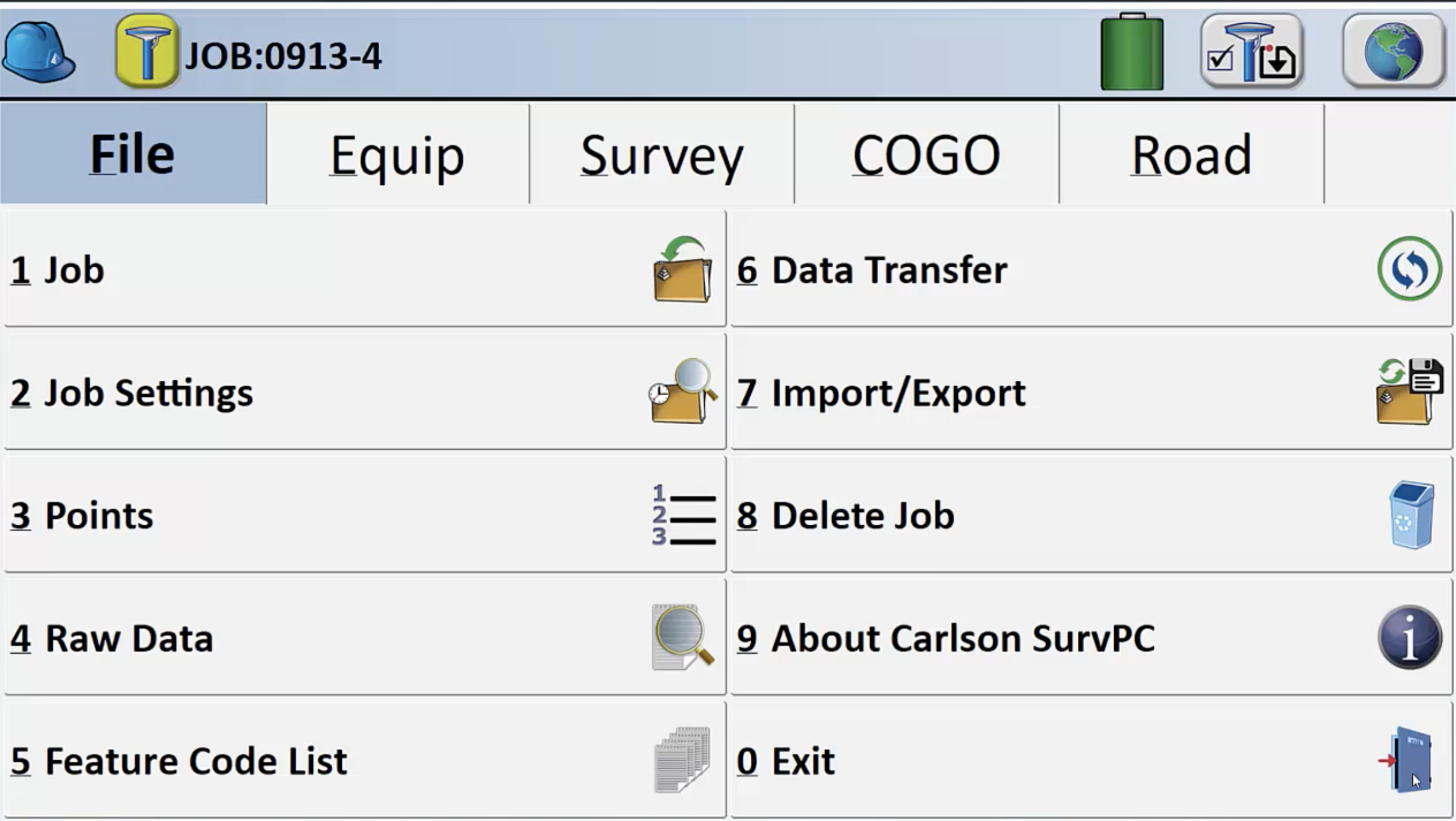
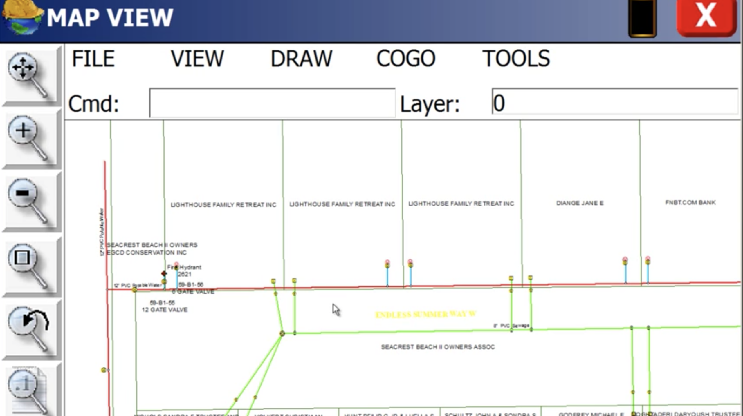
Designed for compatible Windows 10 and Windows 11 devices, SurvPC 7 supports a wide range of RTK GNSS receivers, conventional total stations, and robotic total stations. Its graphical interface provides access to surveying commands, mapping, coordinate calculations, and field data management tools.
Whether collecting topographic survey data, setting out construction points, checking elevations, or managing complex infrastructure projects, SurvPC helps streamline field operations and improve the consistency of survey information.
Key Features & Benefits
- GNSS and total station compatibility: Supports a broad range of RTK GNSS receivers, conventional total stations, and robotic total stations.
- Advanced coordinate geometry (COGO): Perform point calculations, intersections, transformations, offsets, and other surveying computations in the field.
- SurvNet least squares adjustment: Analyse survey observations and identify potential errors before leaving the job site.
- Enhanced GNSS averaging: Improve data quality with graphical statistics, outlier detection, and measurement review.
- Construction set-out and road staking: Work with survey points, alignments, profiles, and terrain models.
- Esri ArcGIS integration: Access and update supported GIS datasets directly from the field.
- CAD and survey file compatibility: Work with formats including DWG, DXF, DGN, LandXML, and SHP.
- Customisable reporting: Generate survey, point, stakeout, and job reports in supported formats.
- Expandable functionality: Optional modules support BIM workflows, tunnelling, monitoring, advanced roading, and hybrid surveying.
Advanced GNSS Surveying & Total Station Control
Carlson SurvPC provides integrated tools for collecting and managing survey observations using compatible GNSS equipment and total stations.
Its GNSS functionality supports RTK positioning workflows, point averaging, and measurement quality checks, while total station capabilities assist with conventional surveying, robotic instrument operation, and construction set-out.
For surveyors working across different instrument types, SurvPC offers a flexible platform that helps maintain consistent field data collection procedures.
Accurate Construction Set-Out & Road Staking
SurvPC supports construction professionals who need to transfer design information into accurate field positions.
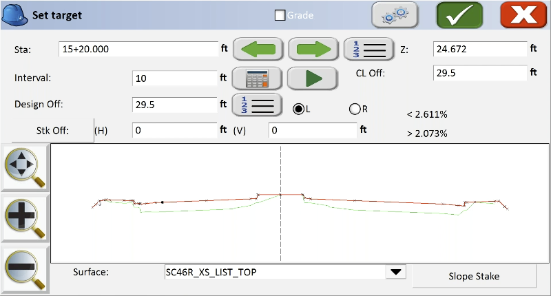
Using point, line, alignment, and road staking tools, operators can establish reference positions, check elevations, and work with project geometry directly from their field controller.
Advanced road functionality supports more complex alignment, cross-section, and surface-based workflows, helping civil construction teams manage set-out requirements efficiently.
Survey Calculations & Least Squares Adjustment
One of the important capabilities of SurvPC 7 is its integration of SurvNet least squares adjustment into field surveying workflows.
This allows surveyors to evaluate observation consistency, analyse measurement quality, and perform adjustment calculations while still on site.
Combined with graphical GNSS averaging, error detection, and detailed reporting, these tools support better-informed field decisions and reduce the need for repeat site visits.
BIM, GIS & Digital Survey Integration
Carlson SurvPC supports modern digital surveying workflows through integration with CAD, GIS, and building information modelling data.
Its Esri ArcGIS functionality enables supported GIS data to be accessed and updated from the field, while the optional BIM module provides tools for viewing and setting out IFC and Revit models in 2D and 3D.
These capabilities help connect survey measurements with design information, supporting coordination between field teams, engineers, and project managers.
Some integrations require additional licensing, accounts, connectivity, or specific software versions.
Ideal Applications
- Land and topographic surveying
- Boundary and cadastral survey workflows
- Construction set-out and site layout
- Civil engineering and road construction
- GNSS and total station data collection
- Infrastructure surveying and monitoring
- GIS asset mapping and field data management
- BIM-based construction layout
- Survey calculations and quality assurance
Windows-Based Field Software
Carlson SurvPC 7 is designed for compatible Windows-based surveying controllers, rugged tablets, and field computers.
Its interface is optimised for field operation, providing surveyors with access to commonly used commands, graphical mapping tools, and configurable workflows.
SurvPC 7 requires Windows 10 or 11, with Windows 11 recommended. Hardware and instrument compatibility should be confirmed before purchase.
Why Choose Carlson SurvPC?
Carlson SurvPC combines professional surveying calculations, flexible instrument support, and advanced data collection tools within a single field software platform.
With GNSS averaging, least squares adjustment, construction staking, and optional BIM and GIS capabilities, it offers a practical solution for surveying and construction teams looking to improve field productivity while maintaining control over their measurement data.
For professionals working with multiple survey instruments or managing complex field projects, Carlson SurvPC provides a versatile and expandable software solution.
Get in touch