Fiof A90 1400 Channel GNSS RTK Receiver
$8,945.00 + GST
A90 features compact design, professional GNSS satellites tracking,cutting-edge IMU tilt survey technology and WebUI control.Bundled Android field software brings a big change in user experience and accessibility.
2 in stock
Features
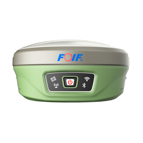
Compact design, more productive
Professional GNSS satellites tracked simultaneously(GPS,Glonass,Galileo,Beidou)
Cutting-edge IMU tilt survey technology is adopted, supporting up to 60° tilt angle
Applies WIFI connection to realize WebUI control designed to modify settings and monitor the receiver status
Bundled Android field software brings a big change in user experience and accessibility
Technical Parameters
| Specification Category | Details |
|---|---|
| GNSS Engine | - Channel: 1408 - Signal received: All constellation and all band reception - BDS: B1I/B2I/B3I/B1C/B2a/B2b - GPS: L1C/A/L2P(Y)/L2C/L5 - GLONASS: G1/G2/G3 - Galileo: E1/E5a/E5b/E6 - QZSS: L1/L2/L5 |
| Performance | - Time Accuracy (RMS): 20 ns - Velocity Accuracy (RMS): 0.03 m/s - Cold start: < 30 s - Initialization Time: < 5s (typical) - Initialization Reliability: > 99.9% - Single - point positioning (RMS): - Horizontal: 1.5m - Vertical: 2.5m - DGPS (RMS): - Horizontal: 0.4m - Vertical: 0.8m - Static: - Horizontal: ±(2.5mm + 0.5ppm) RMS - Vertical: ±(5mm + 0.5ppm) RMS - RTK (RMS): - Horizontal: ±(8mm + 1ppm) RMS - Vertical: ±(15mm + 1ppm) RMS |
| Data | - Internal memory: 8GB standard, supports TF card extending to 32GB - Differential data: RTCM V3.x - Data format: NMEA 0183 - Data security: RTK survey data secured in three ways (synchronizing storage in both controller and A90, and uploading to cloud for backup is available) |
| Configuration | - Bluetooth: Built - in, Bluetooth 2.1+EDR/Bluetooth 4.0 BLE - Electronic bubble: Supported - Tilt survey: IMU inertial navigation module, 6 - axis 400Hz dynamic output, calibration - free - Network communication: Fits various networks - WIFI: 802.11b/g/n, can connect to controller through WIFI replacing Bluetooth, supports WebUI wireless management including firmware update, data download, settings, station setup - Radio: Internal 1w radio (Rx/Tx) with a typical working range of above 5km, external 2/35w radio (Tx) with a typical working range of above 15km, and supports protocols like PCC - EOT, TrimTalk450S, TrimMarkIII, South, HiTarget, GeoTalk, GeoMark, etc |
| Physical | - Size: 156mm*76mm (Φ x H) - Material: Bottom is magnesium alloy and top is polymer plastics - Battery: 7.4V x 3400mAh x 2pcs, smart removable lithium battery (with power indicator) - User interface: 4 LED indicator lights, 1 TF card slot, 1 SIM card slot, 1 button, real - time voice broadcasting, TNC port (connecting built - in radio antenna), 5 - pin lemo port (connecting external power supply and external radio), 7 - pin lemo port (USB + serial port, connecting PC and controller) |
| Environmental | - Temperature: -30°C to 60°C for operating temperature, -40°C to 80°C for storage temperature - Humidity: 100% condensing resistant - Shock: 2 m pole drop resistant in normal temperature - Protection: IP68 |
| Other | - Controller: P9III or P9IV - Software: FOIF Surpad, MicroSurvey FieldGenius - Application: Power system, land, construction, transportation, forestry, agriculture, deformation monitoring, water conservancy system |
Get in touch