iDig Spotman GNSS Rover Kit Construction Layout System
$9,850.00 + GST
The iDig Spotman GNSS Rover Kit delivers accurate construction layout, measurements, and reporting with iPoint software and tilt-compensated GNSS.
1 in stock
iDig Spotman GNSS Rover Kit
The iDig Spotman GNSS Rover Kit is a complete, field-ready GNSS solution designed for construction layout, measurement, and reporting. Paired with the iPoint Android-based software, this kit delivers a powerful yet easy-to-use system for accurate positioning and data capture on site.
Ideal for contractors, surveyors, and site supervisors, the Spotman GNSS Rover Kit simplifies layout and measurement workflows without the complexity of traditional surveying systems.
Key Benefits
- High-accuracy GNSS positioning with tilt compensation
- Intuitive iPoint software for layout, surveying, and reporting
- Android-based platform with fast learning curve
- Supports construction layout, measurements, and volume calculations
- Portable, rugged setup for on-site use
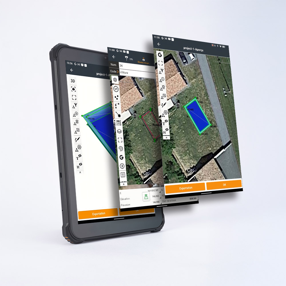
Streamline Your Workflow with iPoint
iPoint is a powerful yet user-friendly software designed to keep operators focused on the field, not the screen. Its guided interface walks users through surveying, stakeout, and volume calculations without complex menus or unnecessary steps.
Flexible Data Compatibility
The system supports a wide range of industry-standard file formats, allowing seamless data exchange with existing workflows.
Supported formats include:
- DWG
- DXF
- SHP
- LandXML
- And more
Visualise Projects in 3D
With real-time 3D modelling directly on the tablet, users can zoom, pan, and rotate models to better understand site conditions and project layouts. This improves accuracy, confidence, and communication on site.
Measure, Quote, and Report with Confidence
The Spotman GNSS Rover Kit allows users to:
- Measure volumes
- Create profiles
- Stake out points accurately
- Generate reliable reports for documentation and decision-making
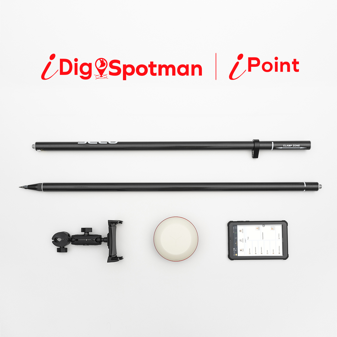
What’s Included
This complete kit includes:
- 1 × CT133 8” Tablet
- 1 × CT141 iPoint Software
- 1 × CT146 8” Tablet (older RAM version)
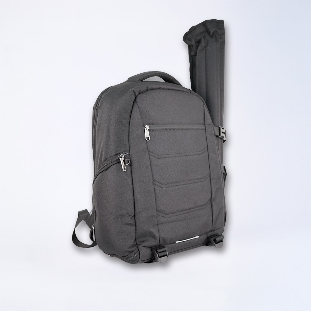
- 1 × Rugged Backpack with Foam Protection
- 1 × CT148 2 m Carbon Pole (4-part)
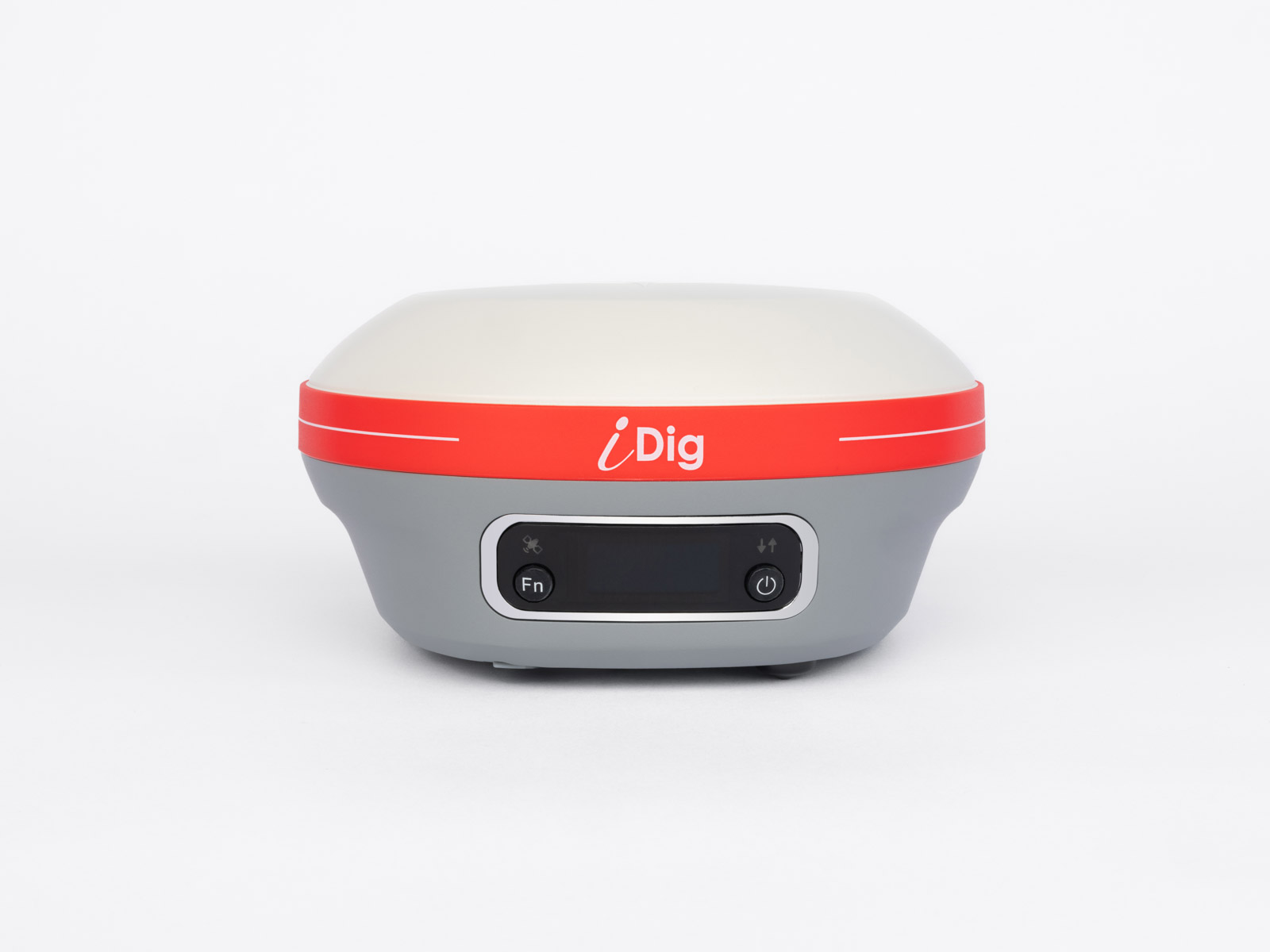
- 1 × CT140T Spotman GNSS Receiver with Tilt Compensation
- 1 × CT152 Quick Release (Male + Female)
- 1 × iDig GNSS Protection Cap
- Free Upgrade: Additional Backpack
Why Choose the iDig Spotman GNSS Rover Kit?
The iDig Spotman GNSS Rover Kit combines accuracy, simplicity, and flexibility in a single solution. It’s an ideal choice for teams who need reliable GNSS positioning and easy-to-use software for construction layout and measurement — without the overhead of complex surveying systems.
Get in touch