by accentu8 | Jul 29, 2019 | Blog
Z-Blade products help to keep surveyors working in challenging environments, and minimize the locations where it’s necessary to employ alternative surveying tools (for example, optical instruments). This unique technology enables surveyors to increase their...
by accentu8 | Jul 29, 2019 | Blog
[Lidköping, Sweden, September 23, 2014.] Handheld Group, a leading manufacturer of rugged mobile computers, today announced the launch of its brand-new NAUTIZ X8 rugged PDA. The NAUTIZ X8 is a handheld computer with superior processing power, screen...
by accentu8 | Jul 29, 2019 | Blog
Working along a control line requires knowing the distance between the defining point A and the target P. To orient the theodolite, you’ll need a second point to position the telescope before measuring the distance.The given line and the distance between P and A...
by accentu8 | Jul 29, 2019 | Blog
Total stations are used wherever the positions of points or both positions and heights need to be determined. A total station consists of a theodolite with a built-in distance meter and can simultaneously measure angles and distances. Here are four basic tasks you...
by accentu8 | Jul 29, 2019 | Blog
If you use the Spectra Precision Survey Pro Survey data collection software package and are having trouble with the new file names in version 5 – you’re not alone. The good news is that there is an easy solution.If you recently purchased Survey Pro v5, upgraded...
by accentu8 | Jul 29, 2019 | Blog
Featuring hundreds of additions and improvements, Carlson SurvCE 4.0 supports the widest range of popular and new release RTK GPS and conventional/robotic total stations of any other data collection software on the market.Newest instrument drivers added for Total...
by accentu8 | Jul 29, 2019 | Blog
The electronic height measurement capability of the newest Spectra Precision digital level provides the accuracy and range for a wide range of survey and construction tasks. Spectra Precision now offers a digital level as part of its surveying product porfolio....
by accentu8 | Jul 29, 2019 | Blog
Cody Corporation Pty Ltd supplies a range of self leveling lazer levels for the surveying, construction, civil and building industries and trades such as concreting, plumbing, electricians, kitchen and bathroom installation, suspended ceilings, interior fitout,...
by accentu8 | Jul 29, 2019 | Blog
Hemisphere GNSS would like to announce the introduction of Crescent™ P206 and P207 multi-constellation, single-frequency boards to the OEM family.The new boards use GPS, GLONASS, and BeiDou, and are Galileo and QZSS ready. While tracking more signals creates...
 RD8200G TX10B Standard Kit (iLoc)
$0.00 + GST
RD8200G TX10B Standard Kit (iLoc)
$0.00 + GST
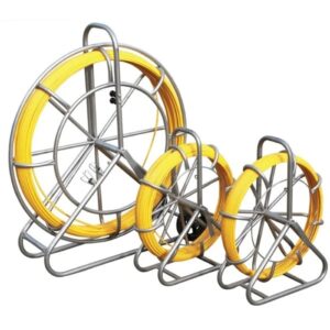 Flexible Trace Push Rod 6mm x 80m
$1,750.00 + GST
Flexible Trace Push Rod 6mm x 80m
$1,750.00 + GST
 Flexible Trace Push Rod 6mm x 60m
$1,650.00 + GST
Flexible Trace Push Rod 6mm x 60m
$1,650.00 + GST
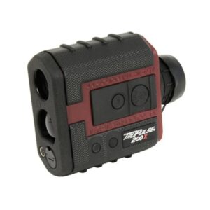 TruPulse - 200X Range Finder (Rugged)
$3,294.50 + GST
TruPulse - 200X Range Finder (Rugged)
$3,294.50 + GST
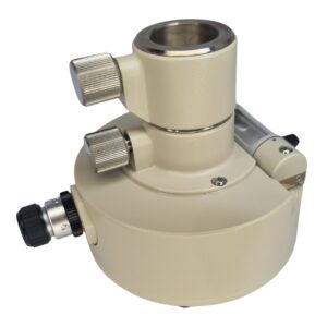 Nikon Tribrach Adapter with Height Adjust & Optical Plummet
$245.00 + GST
Nikon Tribrach Adapter with Height Adjust & Optical Plummet
$245.00 + GST